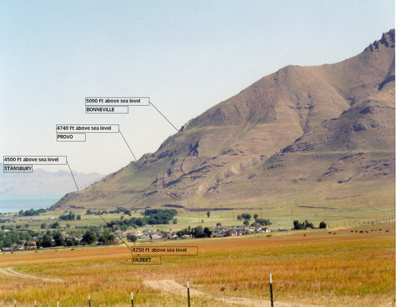
 Great
Salt Lake (remnant of Lake Bonneville) looking North East at the North
end of the Oquirrh Mountains
LAKE BONNEVILLE One
of the earliest inhabitants of the Tooele Valley and other neighoringt
valleys was the fresh water ancestor of the Great Salt Lake, Lake
Bonneville, named after Captain Bonneville, an early explorer in the
region.
It has been established that Lake Bonneville with a maximum depth of at least 1000 feet covered an area of about 20,000 square miles. It extended from southern Iron County on the South to Bear Lake Valley and South Eastern Idaho on the Norht and from the Wasatch Mountains on the East to Eastern Nevada on the West. Major terraces of lake levels (Stansbury, Bonneville, Provo, and Gilbert) (oldest to the Youngest respectively) are clearly visible on the West face of the Oquirrh Mountains and elsewhere in Tooele County. |